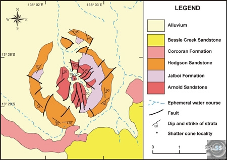
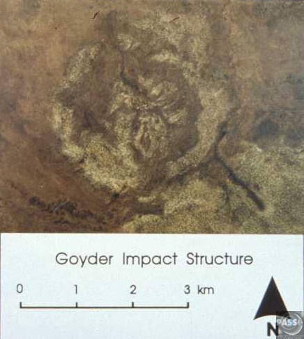
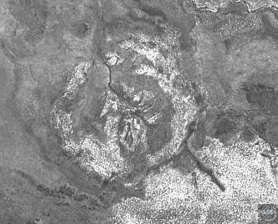
Goyder
| Crater Name | Location | Latitude | Longitude | Diameter (km) | Age (Ma) | Exposed | Drilled | Target Rock** | Bolide Type*** |
|---|---|---|---|---|---|---|---|---|---|
| Goyder | Northern Territory | S 13° 28' | E 135° 2' | 3 | < 1400 | Y | N | S | - |
 Goyder MDE.jpg)
 Goyder ASTER Figura 2D RGB 321.jpg)
 Goyder Figuras 3D RGB (Ex 10).jpg)
1. Goyder geological map - submitted by Peter Haines
2. Aerial Photo Submitted by Peter Haines.
3. SPOT satellite image submitted by Peter Haines
4. DEM Image Provided by Dr. Carlos Roberto de Souza Filho
5 & 6. Image Provided by Dr. Carlos Roberto de Souza Filho
References |
Haines, P. W., Impact Cratering and Distal Ejecta: The Australian Record. Australian Journal of Earth Sciences 52, P. 481 - 507. 2005. |
Haines, P. W., Goyder impact structure, Arnhem Land, Northern Territory. AGSO Journal of Australian Geology & Geophysics, v. 16, pp. 561-566. 1996. |
Haines P.W., Probable impact structre near Brrow Creek, Northern Territory, 1989. |
| * pre-1977 K-Ar, Ar-Ar and Rb-Sr ages recalculated using the decay constants of Steiger and Jager (1977) Ages in millions of years (Ma) before present. ** Abbreviations: C - Crystalline Target; C-Ms - Metasedimentary Target; M - Mixed Target (i.e.sedimentary strata overlying crystalline basement); S - sedimentary target (i.e. no crystalline rocks affected by the impact event). From Osinski. G. R., Spray J. G., and Grieve R. A. F. 2007. Impact melting in sedimentary target rocks: A synthesis. In The Sedimentary Record of Meteorite Impacts, Geological Society of America Special Paper. Editors: Evans K. Horton W., King D., Morrow J., and Warme J. Geological Society of America: Boulder, in press. ***From Koeberl,C. Identification of meteoritic components in impactites. 1998, Koeberl, C. The Geochemistry and Cosmochemistry of Impacts. 2007 and PASSC Files. (IAB, IIIAB, IIIB, IIID - Iron Meteorite) |